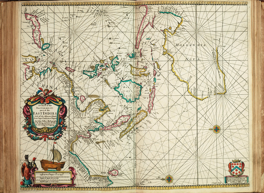
A chart of the easternmost part of the East Indies with all the adjacent islands from Cape Comorin to Japan
Long Caption:A chart from 'Atlas Maritimus', or the Sea Atlas; being a book of maritime charts. Bound sheet. Hand col engr. Scale: [ca. 1:17 000 000 (bar)]. Cartographic Note: North at 270 degrees. Borders graduated for latitude. Plane chart. Bar scales in English and French leagues, Spanish leagues and Dutch miles. Additional Places: Indian Ocean, Australia. Contents Note: Title decorated with a Chinese land yacht. Chart dedicated to Lord George Berkeley, privy councillor, member of the council of trade and the East India Company.Credit line:National Maritime Museum, Greenwich London.Object:PBE6862(20)Artist:John Seller; Francis Lamb (engraver); John Darby (publisher) Date:1675Medium:Hand coloured engravingSize:Printed area 43.5 x 54 cm, on sheet 45 x 55.5cm.
Click here to buy a bespoke print of this image.
Your download will start shortly, please do not navigate away from this page until the download prompt has appeared. Doing so may cause your download to be interrupted.
We use cookies to ensure that we give you the best experience on our website. If you continue to use this site we will assume that you are happy with it.Ok